
Difficult to predict storm track, snowfall amounts days before event, meteorologist says
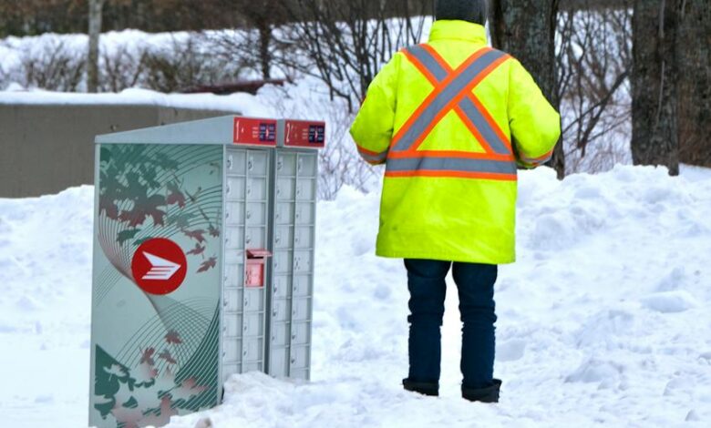
Nova Scotians endured a major and protracted weekend snowstorm that dumped more than 100 centimetres on parts of the province over three days.
Were they forewarned and prepared?
“Every storm poses its own challenges,” Ian Hubbard, a meteorologist with Environment and Climate Change Canada who works out of the Atlantic Storm Prediction Centre office in Dartmouth, said of forecasting weather events.
“This one had a lot of uncertainty leading up to the event at the end of the week and then as things became more clear, then the picture, the weather story began to shape up as to how significant an event this would be.
“There were indications that significant snowfall would be a really good possibility over many areas, particularly eastern and northern Nova Scotia.”
Hubbard said that forecast was borne out by confirmed and unconfirmed snowfall amounts by late Monday morning.
He said there were 88 centimetres of snow reported at the J.A. Douglas McCurdy Sydney Airport from Friday until Monday morning, 83 centimetres at the Halifax Stanfield International Airport, more than 100 centimetres in the New Glasgow and Pictou areas and the highest totals in Cape Breton, with more than 100 centimetres, which is the height of an average kitchen countertop, three two-litre pop bottles stacked on top of each other or the length of an average adult golden retriever dog.
Across Halifax Regional Municipality, snowfall amounts reached 40 to 50 centimetres from as far west as Hammonds Plains, over to Dartmouth, Hubbard said.

What was forecast?
Were those amounts forecast and were people warned?
At 6:40 p.m. on Friday, the provincial Emergency Management Office and the Public Works Department issued a joint statement and news release about a significant snowfall.
“A significant snowstorm is expected to impact the central and eastern parts of the province over the next few days, starting tonight, Feb. 2, and continuing into early next week,” the statement read.
“Environment and Climate Change Canada expects the system to bring heavy snowfall amounts, blowing snow and gusty winds, resulting in reduced visibility and hazardous driving conditions.”

The statement urged Nova Scotians to monitor local forecasts and to stay off the roads, despite the fact that Public Works crews would be working throughout the weekend to keep roads as clear as possible.
The news release was forwarded to mainstream media across the province, posted on social media and made available to people who get the office’s RSS feed, an EMO spokesperson said.
HRM communications staff posted a statement at 4:50 p.m. Friday about how the storm would affect municipal services, including transit, and then followed up with three updates on Saturday, two more on Sunday and two on Monday morning.
Brynn Budden, a public affairs adviser with HRM, said in an email that the municipality has a standard operating procedure for all weather events, whether they be major or minor in nature.
“A variety of regular updates are posted to our website, social media channels at set times before, during and after a weather event concludes,” she said. “HfxALERT, the municipality’s mass notification system, is also sometimes used to communicate both non-urgent and urgent information in a timely manner.”
Reaching out
Budden said the public service announcement distribution list includes municipal staff and more than 100 media, the municipality’s social media channels have a combined following of 139,000 and approximately 30,000 people subscribe to HfxALERT.
Hubbard said it’s difficult for forecasters to come up with snowfall amounts days ahead of a storm.
“It depends on each storm,” he said. “We have a lot of long-range models that we use but the further ahead you’re looking, you introduce a lot more uncertainty in exactly where a storm may go or where the precipitation will be the heaviest. Until you start to see a more consistent picture from those models, it’s really hard to talk about amounts and timing and location.”

Hubbard said storms can weaken or take a different track and he couldn’t really put a timeline on when the trajectory and severity of a storm comes into clear focus because it changes from storm to storm.
“Each storm is different. Sometimes we see them far out and one model might be saying one thing and another might be saying something totally different five and six days out. Then you’ve got a picture saying you’ve got a snowstorm and you get zero snow. That’s one of the challenges, especially forecasting beyond a couple of days.”
Hubbard said Environment and Climate Change Canada issues a snowfall warning for an event that will dump 15 centimetres or more, a winter storm warning for systems that bring higher snowfall amounts and blowing snow or other elements and a blizzard warning for a storm that brings poor visibility over an extended period of time.
“It’s not necessarily how much snow is falling but what it’s going to look like outside in terms of visibility, and that comes from both snow and wind. A blizzard is the worst system we would see.”
Hubbard joked that he had been monitoring the groundhogs across North America for their Feb. 2 predictions and thought they might have jumped the gun by predicting an early spring.
“February tends to be an active month and March can be as well,” he said. “We’ll have to see how they play out as we move towards the spring. We do have a little bit of snow hanging on (Monday) over northern Nova Scotia and then we are going to see improving conditions over the next few days with a big ridge of high pressure bringing some fair weather to most of the Maritimes.
“There are no major systems on the horizon at this point, maybe a little bit of precipitation on the weekend but nothing significant.”