Cutting-edge drone tech maps land and water with laser accuracy

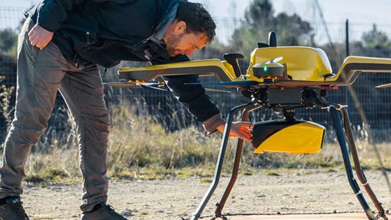
Standing by a river, watching as a drone hums overhead, mapping the landscape with precision – this is the incredible capability of YellowScan’s new Navigator system. Designed specifically for mapping underwater topography in rivers, ponds, and coastal areas, the Navigator is revolutionizing environmental monitoring.
Weighing approximately 8.16 pounds and compatible with professional drones, the Navigator can map shallow waters up to 65.6 feet deep with an accuracy of approximately 1.18 inches. Its key features include miniaturized high-precision sensor technology, adaptive signal processing for challenging water conditions, and an integrated camera for true-color data visualization. With up to 45 minutes of autonomy on a single battery charge, the Navigator is a powerful tool for researchers and conservationists.
YellowScan emphasizes the Navigator’s importance in addressing climate change impacts and advancing environmental research. Its applications range from tracking coastal erosion and sediment movement to monitoring underwater biodiversity habitats and assessing coral reef degradation. The system’s ability to map low-lying coastal areas at risk from rising sea levels and document changes in marine ecosystems provides valuable insights for conservation efforts.
In various sectors, the Navigator has the potential to make a significant impact. In environmental research, it enhances data collection for more accurate assessments. For marine conservation, it aids in monitoring and protecting delicate ecosystems. In coastal protection strategies, it plays a crucial role in combating erosion and flooding. The system also assists in climate migration planning by identifying vulnerable areas. In infrastructure development, the Navigator provides detailed spatial data for efficient planning. And for scientific exploration, it offers new ways to study complex natural environments.
While YellowScan has not disclosed exact pricing for the Navigator, the long-term benefits of efficiency, lower operational risks, and unmatched data accuracy make it a smart investment for those in environmental research, infrastructure planning, or marine conservation. For custom pricing information, interested parties can reach out to YellowScan directly.
YellowScan CEO Tristan Allouis emphasizes the transformative impact of the Navigator, stating, “This technology is transforming abstract climate change discussions into concrete, measurable data.” With the Navigator’s advanced technology, mapping the unseen depths of our waterways is now possible, empowering us to take stronger action to protect them.
To stay informed on tech tips and security alerts, subscribe to the free CyberGuy Report Newsletter at Cyberguy.com/Newsletter. For questions, story ideas, or comments, reach out to us at Cyberguy.com/Contact. Follow Kurt on his social channels for more tech insights, and check out the latest updates on CyberGuy.com.
In conclusion, the YellowScan Navigator is more than just a gadget – it’s a game-changer for environmental research. By providing unprecedented precision in mapping shallow waters, the Navigator is empowering scientists, conservationists, and planners to tackle complex environmental challenges. With this level of technology at our disposal, we have the tools to protect and preserve our planet’s waterways like never before.


